Sorong, Papua Barat

I had a compelling reason to visit Sorong. For as long as I can remember, my parents attended the annual Sorong reunion for Royal Dutch Shell colleagues. When my father was in his late 20s, he worked in Sorong for a couple of years as a crew member on the landing ship, the Kais, which served as a supply ship for the Dutch oil industry. I wanted to visit Sorong while my father is still alive so I could entertain him in his care home with some new stories, hopefully keeping his memory active.

There are no direct flights between Surabaya and Sorong, with a total distance of 2,171 km—roughly the same distance between Amsterdam and Athens. We took a Lion Air flight via Makassar in South-Sulawesi. When flying domestically in Indonesia, about 90 percent of your options are with Lion Air or its subsidiaries. Currently, Lion Air operates 118 aircraft, mostly Boeing 737s. Notoriously, during the 2000s, Lion Air experienced many incidents, some of which were deadly and primarily caused by pilot error. However, in 2016, the airline was removed from the EU blacklist and is now considered safe. Ticket prices are quite affordable, especially given the distance.

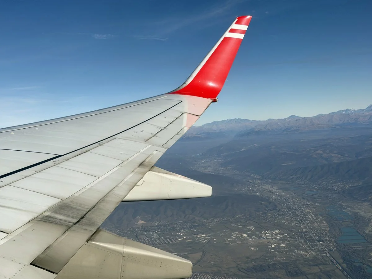
Curiously, our plane was painted partially in Boeing's house colors and partially in Lion Air livery. The 737 looked a bit battered, but, jokingly, I considered it safer than the new 737 MAX. Remember Lion Air Flight 610?

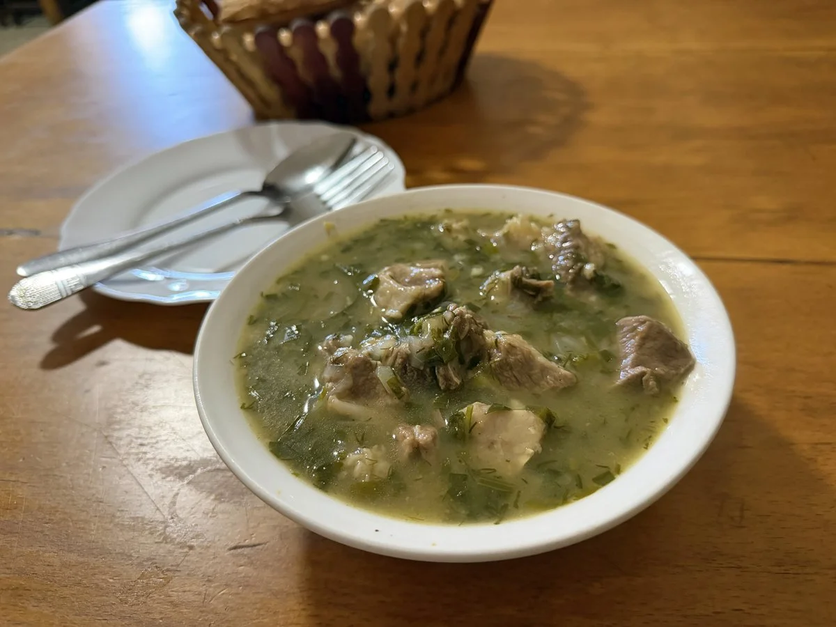
Indonesia has many regional dishes, so during our stopover, I had to try sop saudara, a buffalo meat soup. Since we woke up at 3:30 AM to catch the early flight, it was the perfect breakfast. Another famous meat soup is konro, which is a bone soup. I tried konro in Sorong for breakfast a few days later.

In Sorong, we opted for a homestay, primarily because I wanted a local contact to help arrange transport to Klamono, a name my father had suddenly mentioned in his care home. The homestay was located in a lovely residential area that seemed safe, but the owner had installed corrugated iron plates against the mango tree to prevent thieves from climbing and stealing mangoes at night. A mosque and a church were nearby, and during prayer times, both places of worship used speakers to amplify their messages to the believers—the volume was so loud that conversations had to pause.

Krupuk drying in the sun. The girl is the owner's daughter, who showed us the way out of the neighborhood on our first day.

In the early 1960s my father was housed in simple barracks built by the Americans during the world war. It was a very different Sorong.

In Sorong, there is little visible presence of the Free Papua Organization (Indonesian: Organisasi Papua Merdeka, OPM), apart from some graffiti. "Papua Merdeka" literally means "Papua Independent." However, as recently as 2019, government buildings were destroyed in Sorong, resulting in over 31 deaths in the region.

Papua students are calling for a new referendum. When West Papua was transferred to Indonesia in 1963, following an agreement mediated by the United Nations, many Papuans felt it was done against their will. In 1969, Indonesia organized a referendum known as the "Act of Free Choice", which involved a council of around 1,000 selected representatives from various Papuan tribes. However, significant pressures and intimidation marred the process, leading many Papuans to feel betrayed.

To this day, a movement continues to fight for an independent West Papua. The Indonesian state is hitting back hard, using drones in the warfare against the West Papua National Liberation Army. One case, were the Kiwirok bombings in 2021. I have an excellent 700 page book on this topic: P.J. Drooglever, Een daad van vrije keuze. De Papoea´s van westelijk Nieuw-Guinea en de grenzen van het zelfbeschikkingsrecht (Den Haag 2005).

FWP stands for "Front West Papua," which is a political organization advocating for the independence of West Papua from Indonesia.

Tuna jaw

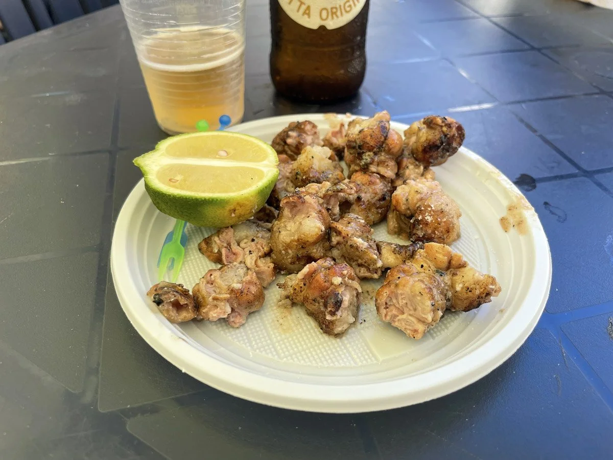
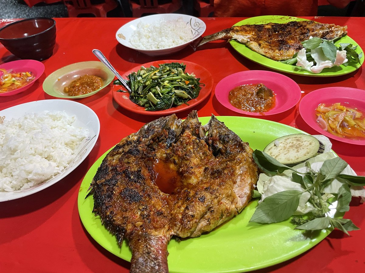
There wasn’t much time on the first day, so we had a deep purple fresh 100% dragon fruit juice and looked for a local restaurant serving fresh fish. A lot of tuna is landed in Sorong, and we came across a restaurant that wasn’t busy, but judging by the plate of the only customer eating there, we decided to go in. It turned out the man was eating a jaw of a tuna fish. We ordered the same, along with another grilled fish. The quality was simply perfect. The head of a fish has the best tasting meat.

A common grilled fish side dish is this spicy tomato sauce. It looks very similar to Malay air assam tamarind.

Ingredients;  3 small shallot (the dark Indian type, not the light Thai type). Peel it and dice it fine, 4 red rawit (birds eye chilli), cut 4 each, 2 red chilli sliced small, 1 semi ripe or green tomato - diced small, a pinch of salt, 1 tsp of sugar, 1 tbsp of fish sauce, 1 ping pong sized tamarind pulp, diluted in 1 cup of water, seeds and pulp removed, juice of 2 jeruk limo. Simply mix all ingredients together.

Of course, Nenik was feeding stray cats with pieces of fish, which led to a cat accidentally scratching her foot. We spent the last hour searching for a shop that sells disinfectant. During our search, we walked past a colorful little restaurant. I’m known for my adventurous palate, but I draw the line at bats. Later, I learned that bats (Paniki in the local language) are consumed as “medicine” for asthma.

Our homestay featured a typical Indonesian bathroom setup. The shower wasn't working, so the water in the white bucket was used for both showering and flushing the toilet. It may be basic, but it functions perfectly.

Pasar Ikan Sorong

Early in the morning, we visited the fish market. Although there were no restaurants, the market was bustling with both fishermen and customers. That evening, we would enjoy grilled fish again, likely purchased at this market just 12 hours earlier.

Streetfood

This lady was baking a mixture of desiccated coconut and palm or coconut sugar in clay holders. We bought some of the baked "cookies," wrapped in banana leaves and still warm. They were simply awesome—sweet and complex.

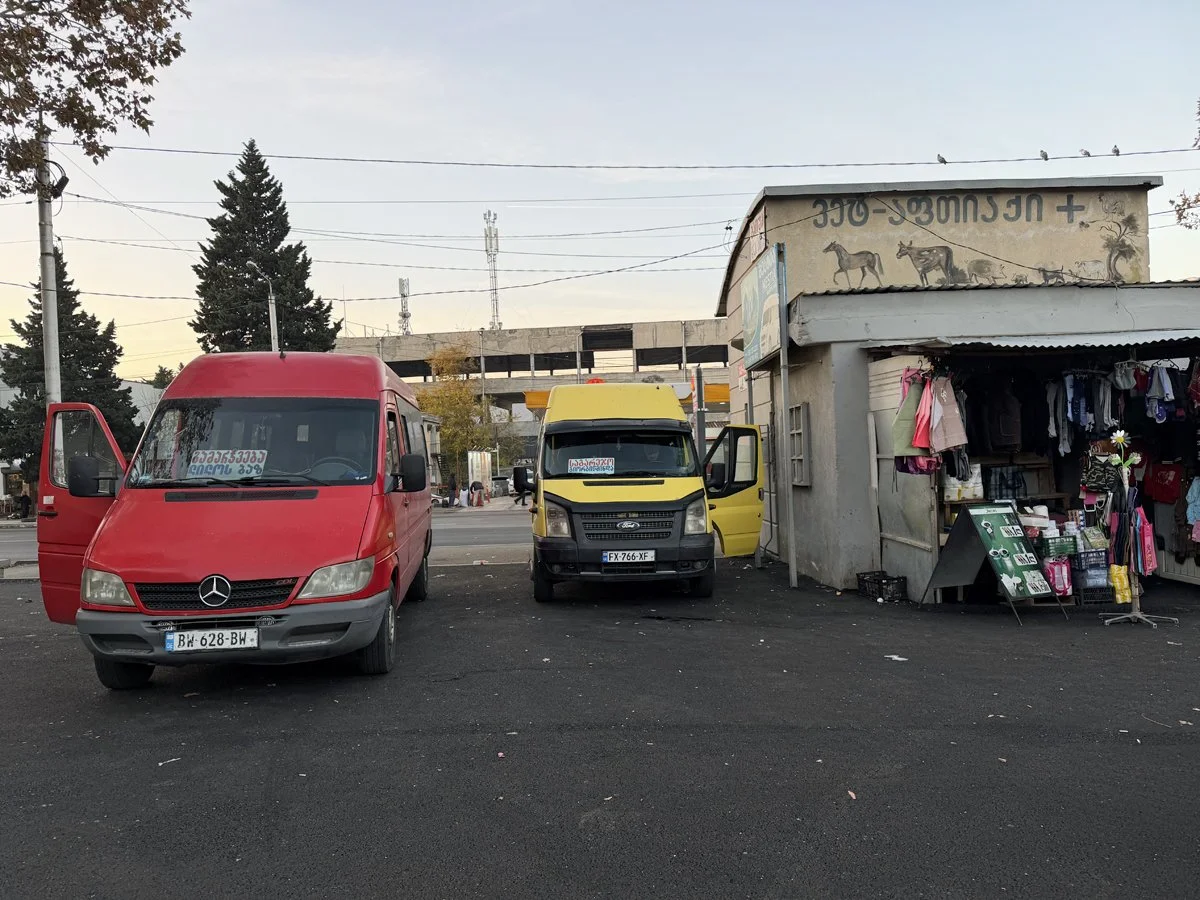
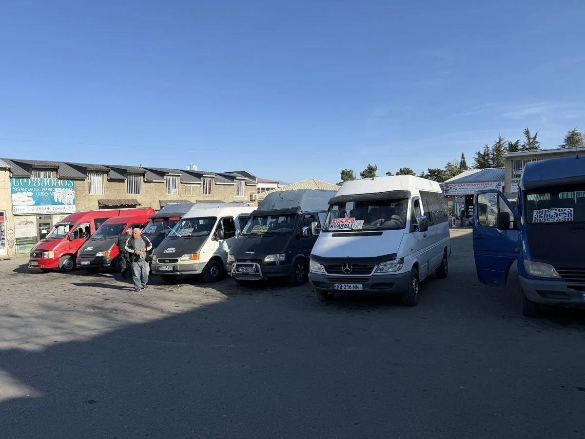
In the afternoon, we explored Sorong. We got around using tiny Japanese minibuses called Angkot (short for "angkutan kota", city transport). Angkots operate on predetermined routes and are inexpensive, although the buses can be quite battered. A single journey costs about 30 euro cents. Alternatively, you can take a Grab taxi, but the Angkots were more fun.

I thought it would be a good idea to visit the Taman Wisata Mangrove just outside of Sorong, but the walking path into the mangrove was closed. The Grab driver then took us to Taman Wisata Alam Sorong, a nature park, which turned out to be a little underwhelming. While there were some nice orchids growing on the trees, it was unclear how to explore more of the forest. I attempted to walk deeper into the jungle, but Nenik exclaimed, “Don’t go there!”

“Why not?” I asked.

“There’s no path!” she replied.

“Yes, there is; it’s just overgrown,” I countered.

“But there might be snakes!” she warned.

Me: “…..”

Taman Wisata Mangrove Klawalu Sorong

Once upon a time, Taman Wisata Alam Sorong must have been proudly inaugurated by local administrators, but it has now fallen into disrepair. There was little to see, and the paths were not well maintained.

Taman Wisata Alam Sorong

There is a strong Chinese presence in Sorong, but the Vihara Buddha Jayanti was only build in the 1980s. The temple was under renovation so we entered without paying the entrance fee.

View from the Chinese temple.

Tembok Berlin

You wouldn’t expect to find a Berlin Wall in Sorong, yet this is the name of a historical site that has become a symbol of independence from the Dutch. It is an old wall dating back to the Dutch colonial era. Today, the area is filled with grill restaurants in the evenings.

The principle is simple: you select a grill place, pick a fish from the table, and look it in the eye. They will grill the fish for you and serve it with rice and the usual sauces. You’ll need to order the vegetables separately.

Separate order: stir-fried kangkung (water spinach) with garlic.

Papeda

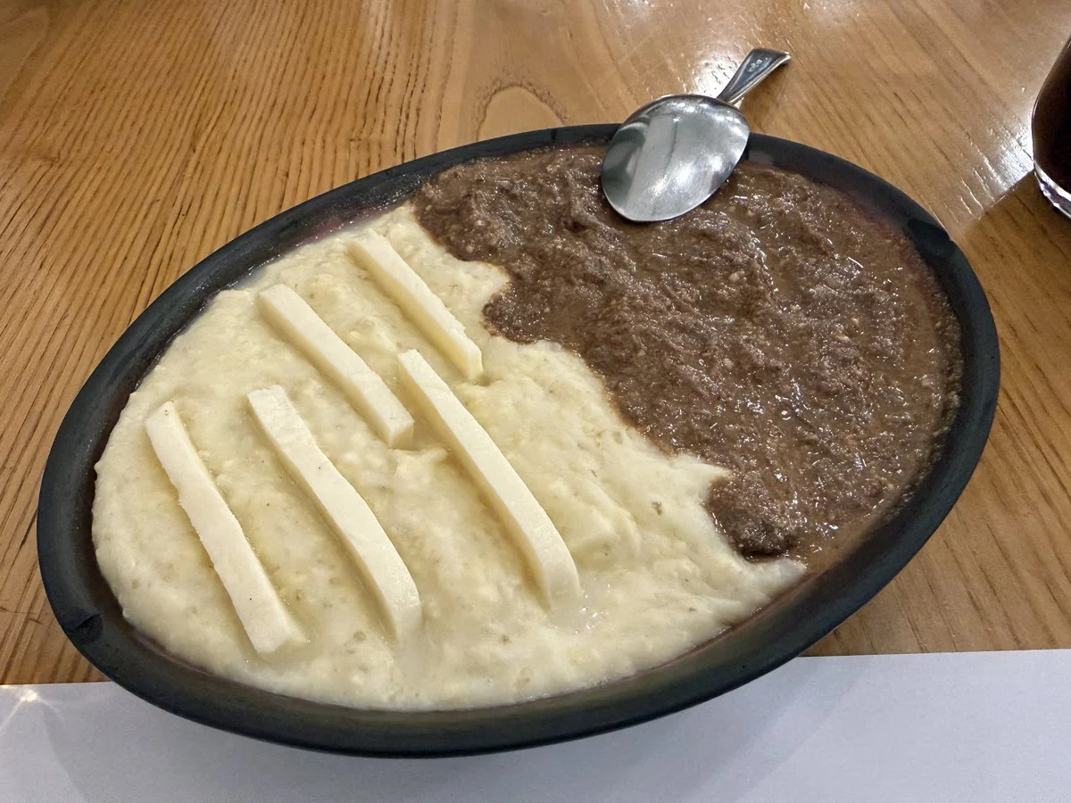
Papeda is a well-known dish found in parts of Sulawesi, the Maluku Islands, and coastal Papua. While it can sometimes be found in restaurants, it's not always available due to the time-consuming preparation involved; you need to pound sago flour with water until a sticky glue-like paste forms. The owner of our homestay kindly prepared a complete papeda meal for us, featuring spicy fish stew and vegetables.

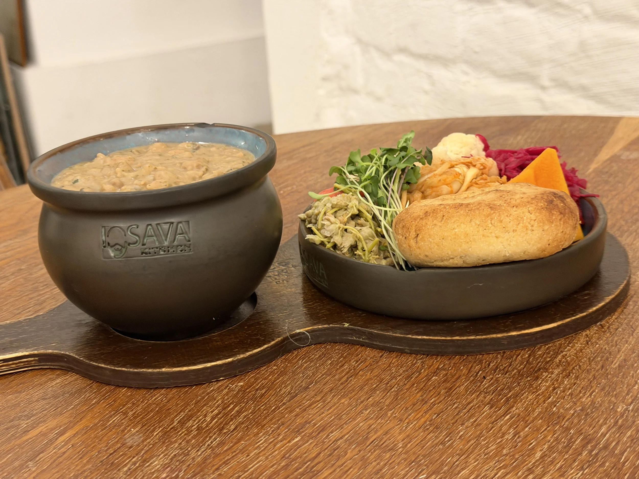
To eat papeda, spoon the kangkung tumis vegetable soup into a bowl, add some of the sago-glue on top, and then pour in the spicy fish stew to taste. The vegetable soup also contained tiny leaves from the edible moringa tree, Moringa oleifera. I had never eaten moringa before; the leaves are particularly nutritious, rich in vitamins A, C, and E.

The oil fields of Klamono

My father worked in Sorong for two years, so I was familiar with the name. According to his own stories, he also visited smaller villages in the Papua jungle. As a hobby, he carried a small metal box with scalpels and some basic medicine, like aspirin, to help treat sick Papua. He never mentioned any specific names, but in October 2024, I pressed him to recall one. "Klamono," he suddenly said. I looked it up on Google Maps and discovered it was indeed a tiny village located roughly 50 kilometers from Sorong. I saved the name and planned to visit Klamono during my time in Sorong, though I had no idea what to expect.

There are no buses to Klamono. We hired a car and driver for the day for 600.000 IDR. When we arrived in Klamono, it looked like a dusty town in the Wild West. I decided to walk around a bit and soon I heard religious music in the distance. The sound was coming from giant loudspeakers attached to an equally giant church. In the greater district of Klamono there are apparently 3,000 people living, in the village the number is less than a 1,000. Not sure how accurate these numbers are, but the church seemed big for the community.

Some men standing near the church were a bit puzzled by my appearance. But they were extremely friendly, although they hardly spoke English. Posing in front of my iPhone broke the ice. Nenik could explain my presence in Bahasa Indonesia. When I asked my father which language the Papua were speaking in the 1960s, he said: kust-Maleis, which is also known as pasar-Maleis or Bahasa Dagang, dagang meaning “trade”. It was the language spoken in coastal areas and trading cities. The Papua also speak a local language called Kais.

We wandered around a bit and a man simply started walking with us, and when we returned to the car he just got in the passenger seat and we had ourselves a local guide.

The Catholic mission was as integral to Nieuw-Guinea as oil exploitation. Some Catholic priests were trained as scientists, studying and documenting the local languages. It wasn’t always easy; some priests lived remotely for years with little contact with the outside world. Additionally, there were problems unique to the Catholic clergy, as highlighted in this quote from the book “Toean, Toean, Kartu Abis!” by Jan Aartsen. The book (“Sir, Sir, We ran out of map!”) chronicles the adventures of the Dutch sailors working on the landing ship Kais in the 1950s.

The next port of call, was the seat of the local ruler, while the Dutch bishop wielded the spiritual scepter there. After the greeting, a local church worker stepped on board with an urgent question: “Did you get any bottles from Sorong?”

With a happy face, he accepted the box of glass bottles. He explained that the sacramental wine was delivered in wooden barrels, which often burst due to the local climate conditions. It was then important to quickly transfer the wine from the barrels to bottles or directly to the ‘users.’ The bishop and his closest spiritual workers drank as much of the wine as possible, to prevent waste, as it was a shame to throw it away. When asked whether the church was perhaps breeding alcoholics, the priest replied that it was not that bad, compared to local administrators.
— “Toean, toean, kartu abis!”, chapter 3

Landing craft Kais

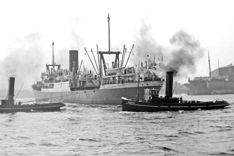
My father was not based in Klamono but in Sorong, serving as a first mate on the landing ship Kais under Captain Piet "Snor" (nicknamed "Moustache" for his large mustache). The Kais was built in 1954 by the Arnhemsche Scheepsbouw Maatschappij N.V. and specifically designed to serve as a supply ship for the oil industry in Dutch Nieuw Guinea. I don’t think the 45-meter vessel could sail all the way to Klamono. My father cannot remember whether he traveled to Klamono by road or via the Klasafet River. The road was barely usable in the late 1950s, so the river seems more likely. The road was primarily used to inspect the pipeline and required regular clearing of the encroaching jungle.

Some of the oil products were used locally to develop the area.

At an incomprehensibly fast pace they built a village (Sorong) from the ground. The roads were paved with the asphalt-rich oil, brought by the Minjak Tanah from Klamono.
— “Toean, toean, kartu abis!”, chapter 3

Photo: 1950s.

Typical landing place for the Kais. Photo: 1950s.

This seems to be the Kais sailing up a river, maybe it could reach Klamono.

One day, my father, Kees, was on board one of the mappi, a small motor launch powered by a powerful diesel engine. Without prior warning, Captain Piet Snor handed my father the steering wheel. According to the story, my father didn’t know how to control the mappi, and after some wild manoeuvres, he accidentally hit the Kais, despite having been the third mate on the 136-meter-long oil tanker Omala just before being assigned to the Kais. The complete chapter can be read here: De mannen van de Kais, hoofdstuk 9

The shock was somewhat dampened by the cork bags protecting the skin of the Kais, but Piet, who had apparently been too flabbergasted to get off his bench, was thrown backwards into the water by the impact.

Kees, as if in a daze, had a brilliant idea and closed the diesel supply tap of the still rushing launch and the boat came to rest. As if in a movie, Kees saw Piet Snor, who looked to him like a walrus in the water because of his fearsome moustache, swimming towards Kais.
— “Toean, toean, kartu abis!”, chapter 9

Below the river and the quay were the ships of the NNGPM would land, bringing supplies.

Below our local Papaua guide. His right arm was about 10 centimetres shorter than his left arm

Just before World War II, the NNGPM (Nederlandse Nieuw-Guinea Petroleum Maatschappij), a subsidiary of Shell, discovered oil in Klamono, though it was of poor quality. During the war, the land was occupied by the Japanese, and it wasn’t until 1945 that the NNGPM could exploit the oil fields in Klamono. A pipeline was constructed all the way to Sorong in the 1950s.

I hadn’t realized there was still oil production in Klamono in 2024. I expected to visit a small village, find little to see, and then head back to Sorong. Discovering functioning pumpjacks—two in total—was a pleasant surprise, and I was as excited as if I had discovered the oil myself. The Papuan children were also thrilled to guide me, a guest from Belanda, to the pumpjacks, making it a highlight of my journey.

There is some localised oil spillage.

In my excitement at finding oil and the distraction of seven Papuan children, I hadn’t paid attention to which phone was used to take some of the coolest photos. Unfortunately, it was Nenik's Android phone, which has a really bad, cheap potato camera. Some of the photos below are not even sharp.

For reasons I still don’y fully understand, this young fellow was so happy to see me he was holding hands with me and at times he was literally clinging to my leg. All the children looked unfiltered happy grinning ear to ear all the time.

If you leave it to the jungle, it will take over every machine left behind.

Another small church in Klamono. opposite the church, in green, is a masjid, so there is a small Muslim population on Klamono as well. But in general the, mostly Dutch, missionaries have succeeded in converting the Papua’s of Klamono to Catholicism.

One young Papuan thought I needed a cool pair of sunglasses for the photo, and now I look like a member of ZZ Top—minus the long beard. The little shop belonged to the parents of the girl in the yellow T-shirt next to me, who was the only one able to speak some English. We tried to treat all the children to candy, but they all declined. In the end, we bought some water bottles for ourselves.

Above some old pre-1960 oil tanks. Below the current oil facility of Klamono.This is a pumping station. I don’t believe I have the complete overview of West-Papua oil industry. There is a report available for download for 125 USD. The oil refinery is located in Kasim, which is 90 kilometers from the oil terminal in Sorong. According to the report summary the Papua oil field recovered more than half of its total recoverable reserves, with peak production in 2020. Based on economic assumptions, production will continue until the field reaches its economic limit in 2069.

The oil company now based in Klamono is Pertamina, which is state owned by Indonesia. In 1957, Royal Dutch/Shell's assets in Indonesia were nationalised, from which Permina was founded. In 1968 Pertamina was created as merger between Permina and Pertamin.

Lunch in Klamono was definitely not Papuan. The only restaurant was run by a family from Madura, an island off the coast of East Java. A case of transmigration. I had ayam goreng lalapan, which consists of fried chicken and fresh vegetables.

In the afternoon we drove around the district Klamono. Below is Block B, apparently Indonesians are living here who came to West-Papua as transmigrants. The Indonesians call the movement of people between the different parts of Indonesia transmigration. They are often people from Java seeking job opportunities in parts of Indonesia with more space.

I never questioned how dragon fruit is grown, but in Klamono we drove past some dragon fruit cacti. It is the flower of a cactus native to the region of southern Mexico and along the Pacific coasts of Guatemala, Costa Rica, and El Salvador.

On our way back to the main road, a group of Papuan children waved at us. It would have been rude not to stop for a chat and another photo opportunity. They greeted me by kissing the back of my hand and then briefly placing my hand on their foreheads.

After our tour of Klamono, I felt we should give our impromptu guide something, but I had no idea what would be appropriate. In the end, Nenik gave him some money to buy betel nut, which he seemed pleased with.

In Sorong, I had noticed many red splashes on the pavement that I couldn't quite place. It turned out to be the spit of betel nut chewers. You buy the betel nut and betel leaves along with a mustard stick dipped in slaked lime powder, and then chew the combination, spiting out the red saliva.

How it ended for my father.

Politics had put an end to the future of a Dutch New Guinea and Kees flew via the airport at Yefman with a small local plane to Biak to transfer to a Stratocruiser of the Panam and fly first class to Manila. After a night in a hotel with film star treatment, he continued via Saigon to Singapore. Apparently he was not allowed to go home yet. On the second day he was called by someone from the office in the Singapore hotel.

’How long do you need to pack,’ was the question. ‘Five minutes,’ said Kees. ‘Then you are the man I am looking for,’ came the sound on the other end of the line, ‘you are going to board the tanker Saroena, which will pass through the Strait in three quarters of an hour, but is not allowed to dock because it is sailing in Indonesia’.
’What about a visa?’, mumbled Kees.
’No time.’ And indeed, three quarters of an hour later, Kees boarded a sailing Saroena, from the agency’s little Shell boat, and was probably treated in the ship’s log as a picked-up drowning person.
— “Toean, toean, kartu abis!”, chapter 9

Driving back to Sorong I noticed the Dutch made pipeline. Somebody told me it is still the original pipe, which was laid in the 1950s but I find it hard to believe. In the 1950s the road was difficult to navigate and inspections were carried out by motorbike and even from a Bell helicopter. In the 1990s the road between Sorong and Klamono was properly asphalted.

Spice Island

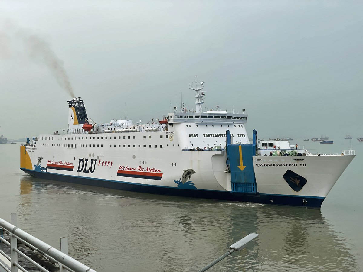
We had plans to visit Raja Ampat from Sorong, but we soon discovered it was a hyped Instagram destination. Instead, we diverted our plans to spend a couple of days in the Maluku Islands, known in the Netherlands as the Molukken. It's hard to grasp the sheer size of the Maluku Islands, we only visited Ambon because the airport is near Ambon City, along with the spice island of Saparua. There are an estimated 1,027 islands in the Maluku, with Ambon being the most developed, yet relatively small. The Dutch conquered Ambon from the Portuguese in 1605.

We had a comfortable yet affordable hotel in the city center of Ambon, a lively city. In 2019, UNESCO officially designated Ambon as a Creative City of Music. We strolled around for a couple of hours, waiting for the night food market to open. During the day, the food market is a bustling street with cars, but in the evening, the road is blocked and dozens of restaurants are set up. Most places serve grilled fish, but you can also find chicken dishes and goat.

At the night market, you select your fish for grilling. A serving of white rice is included, along with two sauces: a regular sambal and a spicy tomato sauce. The spicy sweet and sour tomato sauce, also served in Sorong, pairs perfectly with grilled fish. We also ordered kangkung (water spinach) and sambal peteh. I thought I had tasted the best grilled fish ever in Sorong, only to be convinced again in Ambon that I had discovered the best grilled fish yet. It was truly that good.

Stir-fried kangkung (water spinach) and garlic, chilis and papaya flowers.

Sambal peteh is made by frying cabai merah (long red chilies), cabai rawit (bird's eye chilies), garlic, shallots, and tomatoes. Lime leaves and peteh beans are added for extra flavor. Some recipes also include tempoyak, which is made from fermented durian.

The ferry to Saparua leaves early in the morning, so once again, we didn't have time for nightlife. I had my first and only beer in Indonesia—a giant 620 ml bottle of lukewarm Bintang beer. The bar had live music, but the songs were mostly international classics. It was almost empty, except for a retired Dutchman, originally from Germany, who had just married a much younger woman from Ambon. He approached me and bluntly asked, “Ben je Nederlander?” He guessed correctly. I tried to finish my warm beer and wished I had ordered fresh fruit juice instead. As we left, we high-fived the singer.

I still have to get used to the idea that Indonesians love to pose with about anybody they meet for no particular reason, like a random hotel front desk clerk in our hotel in Ambon. In a way it’s kinda fun, but who is this guy?

Journey to Saparua

To reach Saparua you first have to cross Ambon to reach a small port where the ferry boats to Saparua leave. The Grab taxi ride takes almost an hour, the boat ride takes about the same amount of time.

Upon arriving in Saparua, you immediately sense its rich history. I could almost imagine the sounds of Dutch hemp ropes squeaking under the tension of the wind as the VOC crew gazed at the same emerald green forest when their ship moored at a distance from the coast. In reality, the VOC ships sailed toward the bay, where Fort Duurstede was built in 1691 after Fort Hollandia was destroyed by an earthquake in 1671. The scale of Benteng Duurstede isn’t particularly impressive; initially, only 10 soldiers were housed in the fortress.

On Saparua, there are very few cars, and the minibuses serve as taxis; they can be expensive if you take one without a larger group. The best mode of transport is on the back of a scooter. It’s about 5 kilometers from the port to Saparua village. I soon discovered that my Indonesian eSIM wasn’t working, and just before we boarded the ferry, I noticed that Booking.com didn’t have any listings available. After arriving on Saparua, I found myself basically offline, as the hotel we found didn’t offer Wi-Fi.

Cloves drying on the street.

Our hotel courtyard.

Just across the street from our hotel there was a very decent restaurant. I got myself a bakso soup with a giant filled meatball called beranak. We shared some fried tofu and tempe penyet and Nenik got an ayam geprek, which is smashed chicken. Penyet means squeezed, and refers to the light squeezing of the tempe to release its flavours.

Ayam geprek.

Benteng Duurstede

The fortress (Benteng in Indonesian) was extensively renovated in the 1990s. The original buildings inside the fortress remain as foundations. The outer walls have recently been painted white, and somebody cleaned the few remaining cannons during our visit. The entrance fee is based on a donation, and I contributed a little more than usual on behalf of my Dutch ancestors, even though one family line of mine lived in what is now Germany during the time of the VOC. I had to record my name, and in the comment section, I wrote: “a long and difficult history.”

You cannot travel to Saparua without learning the story of Pattimura. For starters, the airport in Ambon is named Pattimura Airport. His real name was Thomas Matulessy, and in 1817, he led a rebellion against Dutch colonial rule. Matulessy’s forces successfully captured Fort Duurstede, resulting in the deaths of Captain Van der Hellen, his wife, their three youngest children, and a garrison of 19 soldiers. Matulessy has been used as a symbol of both Maluku independence and Indonesian nationalism. He was declared a national hero in 1973 by Sukarno, recognised not by his birth name, but under the title Kapitan Pattimura.
Statue of Thomas Matulessy

In the afternoon, it started to rain, and we sought shelter in the small shop of a Chinese man. I noticed shark fins hanging from the ceiling, and he proudly showcased some of them. They fetch 1.5 million rupiah per kilo, less than 90 euro. The man was the husband of a lady we had met on the ferry, who was active in the church and also a businesswoman—what I would describe in Dutch as a “handige tante.” Earlier, Nenik had mentioned our interest in buying cloves and sago, and before we knew it, the lady claimed she had already purchased a kilo of cloves and two boxes of sago for us. It was hard to back down, even though I had already bought 200 grams of cloves just before. Nenik handed her some money for the cloves and sago. At that point I still assumed we bought sago flower for making papeda.

The next evening, just before we left, the couple appeared at our hotel with two giant boxes filled with sago blocks and a kilo of cloves. I was stunned. How could we carry these boxes all the way to Surabaya? We quickly gave one box to the hotel staff and managed to lug the other box all the way to Surabaya and the village of Durenan.

More sea creatures used for Chinese ‘medicine’.

While we were waiting for the rain to stop, Nenik suddenly followed her nose, disappeared, and returned with a siomay—fish dumplings with vegetables doused in peanut butter sauce. This dish has its origins in China, where it is called shumai. I had eaten it before at a pasar malam in the Netherlands, and I adore the taste.

Warehouse with bags of cloves. I bought 200 gram of cloves.

The humble nasi goreng.


Nolot

The next day was Sunday. We hired two scooter drivers and headed to Nolot, a predominantly Christian village on the other side of the island. Most villagers were at church, and as we walked around, some services were ending. Churchgoers, dressed for Sunday, filled the streets. One church had a complete brass band playing songs, which reminded me of the Dutch 1993 anthropological film by Johan van der Keuken “Bewogen Koper” (Brass unbound), which explains the global distribution of brass music through colonial military brass bands. The scenario was partly written by anthropologist Rob Boonzajer Flaes, connected to my University of Amsterdam.

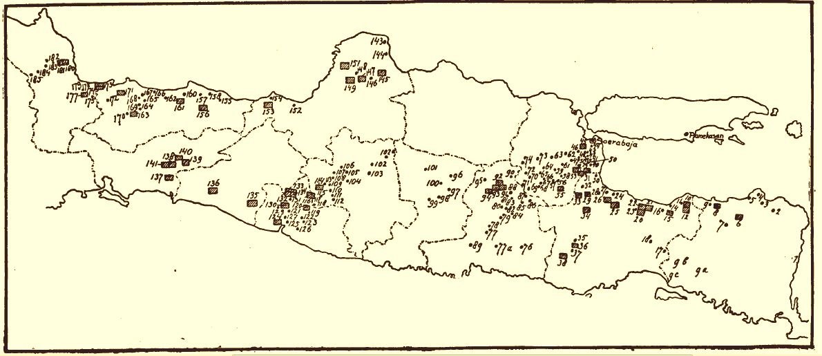
Drying sago blocks in Nolot. Little did we know we would end up with two large boxes of this stuff just a day later. The sago is baked in sago ovens, which imparts a smoky flavor to the blocks. After baking, the blocks are dried and then ready for consumption. Roy Ellen and D. Kyle Latinis published a study in 2012 titled "Ceramic Sago Ovens and the History of Regional Trading Patterns in Eastern Indonesia and the Papuan Coast."

Two types of ceramic sago oven produced in Keligah, East Seram in 1986.

Distribution of ceramic sago ovens in: (a) island southeast Asia as a whole, (b) Maluku, and (c) Ambon-Lease and West Seram;

In Nolot, Christmas and New Year's wishes are permanently painted on the walls, along with nativity scenes sculpted from concrete. I dubbed Nolot the village where Christmas lasts 365 days a year.

Jesus standing on a globe.

Due to strong low and high tides, the coastline is composed of mangroves.

We made the mistake of relying on an open restaurant for breakfast, but because it was Sunday and Nolot is a really small village, nothing was available. By 12:30 PM, we were quite hungry and decided to drive back to Saparua village. However, just as we were leaving, we passed a lady’s house with a small shop selling rujak buah, also known as rujak manis.

Side note: There are many different rujak recipes in Indonesia; just on Wikipedia, there are more than twenty. For rujak buah, you need a flat cobek, which is how Nenik noticed the shop. I would have driven right past the house without realizing it was a restaurant.

First, you grind some salt and fresh rawit (chili pepper) into a paste. The lady asked me how many rawit I wanted; I requested five, while Nenik and our two scooter drivers opted for just three. Next, you add fried peanuts and continue grinding until you achieve a coarse paste.

The next step is to add palm sugar, and to balance the sweetness, you can also include tamarind paste. However, I didn't see the lady add any tamarind (asem jawa), unless the block of palm sugar was pre-mixed with it. You can also add some trassi (shrimp paste).

Then comes the fruit. Pineapple is very common, and it was also the season for Malay apples (jambu bol). You can basically add any seasonal fruit, and she also had a bowl of pre-cut fruits available.

Mix everything together, and you have the perfect fruit salad.

We spent our last afternoon in Saparua swimming in the sea, fully clothed. Nenik chatted with many children in Bahasa Indonesia, while I managed little more than responding to the question, “Hey Mister! What is your name?” I took the photos below after swimming, but by then, the golden light of the setting sun had faded. It was a magical afternoon, and the children's faces glowed with a copper hue from the sunlight.

We opened the boxes filled with sago blocks to ensure we weren't smuggling drugs, but they contained only sago. Back in the Netherlands, I tried one of the blocks—you're supposed to dip them in coffee or tea, which softens the block, allowing you to eat it like bread. However, it is quite tasteless, and if you didn't grow up eating sago in this form, it really isn't very enjoyable. Nenik gifted some of the sago blocks to a Dutch-Indonesian friend from the Molukken, as they evoke childhood memories for him.

Our last meal in Saparua was a simple nasi goreng and tempeh penyet. Along with pecel, these are among the simplest meals you can find in Indonesia. I could eat this every day!

Benteng Amsterdam

In Ambon, we had four hours to spare before our flight to Surabaya. Having spent my entire adult life in Amsterdam, I couldn’t pass up the opportunity to visit Fort Amsterdam. The blockhouse inside the fortress was built in 1637 by the VOC. Although the fortress was restored in 1991, it has lost much of its historic charm, likely due to the fresh white paint. Next to the fortress is Café Amsterdam, but it appeared completely deserted; I could only find one bar stool.

Naxos / Νάξος

Ἀνερρίφθω κύβος . The dice is cast. My ticket to Athens is booked, and from the airport, I will head straight to the port of Piraeus to catch a boat to Naxos. Thanks, Tony. I stumbled upon Naxos thanks to Anthony Bourdain's 2016 episode of Parts Unknown, filmed there.

I find inspiration in Bourdain; perhaps it’s those well-crafted one-liners, like, "Is it worse to be someplace awful when you're by yourself or someplace really nice that you can't share with anyone?"

Then, at 61 years old, he took his own life.

This journey will be another opportunity to contemplate loneliness. Great hiking trails too.

Dionysus

It was time for another attempt at a long hike. This time, I fat biked to Chalki (Χαλκί), also known as Halki, and found the footpath to Moni. The distance is roughly 5 kilometers. Moni is about 500 meters above sea level, and it’s an easy path when you’re fit.

Hiking from Chalkio to Moni.

In Moni, the cats have their own little houses. The village is known for its textiles, and several women approached me, trying to sell me pieces of cloth. However, my small two-room apartment in Amsterdam has no space left for souvenirs, so I had to politely brush the ladies off.

There are a few taverns in Moni. I ordered a Freddo Espresso. The interior featured a mermaid painting and a small photograph of Karl Marx. Traveling off-season, I was the only tourist in Moni around noon.

On my way down I was followed by a Cyclops.

Back in Chalki, I returned to the same restaurant for lunch and chose the eggplant in tomato sauce, which looked amazing and would have tasted great.

It was one of those times when the plague became invisible. This silence, this death of colours and movement, could belong to summer as much as to the pestilence
— Albert Camus, The Plague

Yria Sanctuary of Dionysus

In the morning I cycled to the sanctuary of Dionysus. It was striking how agricultural the land is. These are the fertile plains of Naxos. The road leading to the sanctuary isn’t asphalted; it’s just a dirt path lined with green potato fields. Autumn is the best season for Naxian potatoes.

The existence of a Temple of Dionysus was mentioned by Herodotus, but its location was forgotten over the centuries. In the 1960s, archaeologists studied a Byzantine church on the plains near the Chóra and conducted test drills in a field nearby, ultimately discovering the missing temple. However, it would take decades—until the late 1980s—before Greek and German archaeologists excavated the temple area. They found the bases of pillars and wall foundations from several temples built at the same location over two thousand years.

The current site features the partial reconstruction of some pillars and the foundation of the temple. It is believed that the place of worship dates back to the 14th century BC (Mycenean era), which is a long time ago.. From around 850 to 750 BC, during the Geometric period, four buildings were constructed, and in 580 BC (Archaic period) the last monumental temple was build.

An overlay of a drawing of the 580 BC temple can be seen against the current remains in the background. The roof, including the roof tiles, was made of marble, which was an innovation at that time. Due to political developments, Naxos lost its power by 477 BC, and the temples of Dionysus, Demeter, and the unfinished temple of Apollo were the only temples built on Naxos.

In the afternoon, I realized I hadn’t even taken a swim in the sea. I needed to head back to my villa on my fat bike to grab my swimming trunks and a towel. The importance of traveling with a towel cannot be overstated. Every interstellar hitchhiker knowns this. “You can lie on it on the brilliant marble-sanded beaches of Santraginus V, inhaling the heady sea vapours”.

The crystal-clear blue water evokes a sense of eternity on a calm day. The tiny ripples seem suspended in time. Nothing is moving, not even my mind. I had lunch in an almost empty restaurant, where tables and chairs awaited better days. For me, the empty chairs inspired thoughts of my future plans. I envision having a small outdoor space I can call my own, dedicated to a little table and at least two chairs to host a future female friend. That’s all I want from life at this point: to share a meal with someone.

In the clear water, I was surrounded by at least a dozen young saddled seabream. They seemed eager to nibble on my legs and were not afraid of me; these little fish appeared to feel invincible.

Despite the goats reminding me of the goat stew I had seen on the menu, I was too tired to visit the Paradise Tavern in the evening. Instead, I bought sheep’s yogurt and kefir and spent some time reading Camus’ The Plague. I couldn't help but chuckle when I read about civil servant Joseph Grand polishing the first sentence of his book and failing miserably.

Triumphantly, he read out the sentence: ‘On a fine May morning, a slender woman was riding a resplendent sorrel mare through the avenues full of flowers of the Bois de Boulogne.’ But when it was read aloud, the repetition of ‘of’ at the end of the sentence sounded ugly and Grand stumbled a little over it. He sat down, seeming crushed.
— The Plague, page 104

Third and final chapter: Zeus, and Apollo I guess

Doha

Few destinations have been as eagerly anticipated by me as the city of Doha. When I last left Doha, it was a town of 80,000 people; by 2024, the population has grown to 1.2 million, making it only slightly larger than Amsterdam. Although Doha is not a vast metropolis, it maintains a human-scale feel. I booked a hotel within walking distance of the old Souq Waqif, which was established in the late 19th to early 20th century.

Souq Waqif سوق واقف

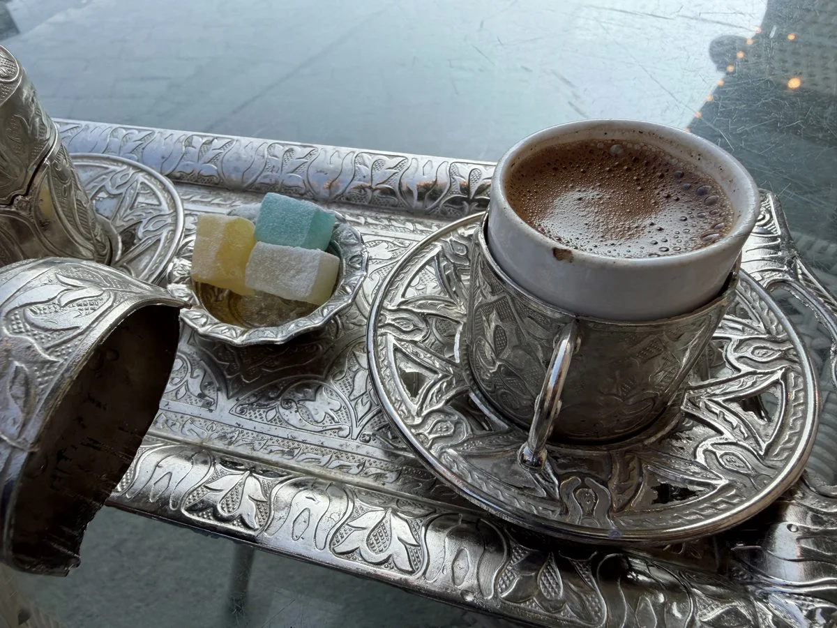
In 1969, we lived not far from the souq. As I sat down for breakfast, I listened to the music from the vintage radio on display, enjoyed the morning sunlight, inhaled the aroma of cardamom from my coffee, and felt completely at peace. My sensory experience was likely similar to what my parents experienced 55 years ago, although I never heard them rave about Arabic coffee. My father insists he didn’t drink it.

Visiting Doha, or any Arab Gulf nation, at the end of May is considered off-season. Temperatures typically reach 43 degrees Celsius at midday, which most tourists find too hot. However, I wasn't bothered by the heat. In Doha, a cool sea breeze can often be felt, making the temperature feel just below 40 degrees.

Souq Waqif on a postcard, late 1960s.

Qatari coffee

Breakfast in Souq Waqif included unsweetened Arabic coffee and a simple chapati, which can be filled with egg, cheese, or both. The souq is a great place to buy spices, kitchenware, and clothing. I purchased a handmade Qatari agal with tassels, although I'm not sure when I would wear it outside the Arab world.

Katara Cultural Village

Katara is like a village within Doha, opened in 2010. I visited Katara after seeing it highlighted on the in-flight entertainment on Qatar Airways, but I found it wasn't really for me. While it's intended to reflect the country's cultural and architectural heritage, all I could see were unappealing buildings. However, it does host many cultural festivities, so perhaps I shouldn't judge too quickly.

The beaches of Katara appear to be private; I was kindly escorted away by security guards three times before I gave up. You can't touch the sand.

One non-alcoholic drink I learned to love was a mint-lime drink.

Doha Metro الدوحة

The Doha Metro, which opened in 2019, still looks brand new five years later. Each train has three compartments: family, general, and gold. The family section is designated for women, while the gold compartment is accessible to anyone willing to pay extra for a journey and a gold membership card. All trains, built in Japan, are driverless.

Museum of Islamic Art

The MIA (Museum of Islamic Art) is definitely worth a visit. Designed by Chinese-American architect I.M. Pei, it opened in 2008 and was newly renovated in 2022, so it looks brand new. The collection is extensive, spanning three continents—Asia, Africa, and Europe—and showcases 1,400 years of Islamic influence.

What was done was worthwhile
— Iraq, probably Basra. Abbasid period, 9th century CE

This folio belongs to the 9th Century Blue Quran, written in Kufic script. It was likely produced in Tunisia or Spain, although its exact origin remains unknown. During the Ottoman Empire, the 600 folios were scattered, with many pages ending up in museums around the world. The indigo-colored parchment is even more beautiful in person; photos do not do it justice.

Al Wakrah الوكرة

Al Wakrah is a city with 90,000 inhabitants located just south of Doha. It can be reached by taking the red metro line to the final station, Al Wakrah. From there, you can either take a local bus or a taxi to Souq Waqif Al Wakrah. While it may appear to be a restored old souq, it is actually a completely newly designed space featuring heritage elements. It's a fantasy, but I must admit it has been executed with great taste.

Iced karkadé

Camel patrol on the Al Wakrah beachfront while I was sipping my iced hibiscus drink, called كَركَديه karkadé in Arabic. I visited Al Wakrah every day just before sunset because it is such a relaxed and quiet place to be.

I appreciated the traditional dallah served with Qatari coffee and dates. I love this way of serving coffee, as a tea light keeps it hot, allowing you to sip from tiny cups. This approach is far more relaxed than having to finish a cup of coffee before it cools.

Al Wakrah fishing harbour

Al Wakrah has a small fishing harbor that is off-limits to unauthorized persons. I managed to slip past the security guard by pretending I was meeting someone. Once inside, I was amazed to see that wooden dhows are still used for fishing, although they are now motorized, and the crews are typically Bangladeshi or Indian. Each dhow tends to specialize in catching one type of fish.

In the Souq of Al Wakrah, grilled fish restaurants abound. When ordering, you can choose how you want the fish spiced: Arabic with no chili or Indian with plenty of chili. The grilled fish is generally of good quality; I tried the sea bass. 'Mandi' has its origins in Yemen and is made by cooking basmati rice in spiced meat stock.

Back in Doha, the city truly comes alive at night. You can take a boat trip on a dhow toward the West Bay and its colorful high-rise buildings.

Al-Ahsa Oasis

I have to admit I completely missed the 2017 diplomatic conflict between Saudi-Arabia and Qatar. What I assumed was a three-hour bus trip between Doha and Al-Hofuf turned out to be an international flight from Doha to Riyadh, followed by a two-hour train journey on the 1980s Dammam-Riyadh line.

Dammam–Riyadh line

I came to Al-Hofuf to see the Al Ahsa Oasis, which has been protected as a cultural landscape by UNESCO since 2018. With 2.5 million date palm trees, it is the largest oasis in the world. I had hoped to study the water management, but I only had one day and too little time for that. The oasis is so extensive that taxis are necessary to travel from one location to another.

Al-Qarah Mountain جَبَل ٱلْقَارَة Jabal Al-Qārah

Within the oasis is Al-Qarah Mountain, a mesa about 75 meters high with caves formed primarily by water erosion. The temperatures inside the caves are quite pleasant, which is why they have been inhabited since ancient times. Now, the caves have been turned into a tourist attraction called The Land of Civilisation, and I was the only visitor that morning.

Before entering the caves, I purchased some dates for breakfast. I love the practice of replacing the pits with almonds. While I was never a big fan of dates, after tasting them in Saudi Arabia, I have become a fan—you just need to buy quality dates.

Entrance to the caves.

People inside Al-Qarah Mountain, 1924 A.D.

Before entering the caves, I was led through a small exhibition about the history of Islam. This is Saudi Arabia flexing its soft power muscle. The host spoke perfect English, and at the end of the tour, I was handed a bag with some gifts: two paper cups of Arabic coffee and dates (which came in handy as breakfast in my hotel room), an English translation of the Quran, and some Vision 2030 leaflets.

Al Khalifa Heritage Museum متحف الخليفة التراثي

Once upon a time, the oasis was the only place in Saudi Arabia where rice was grown. However, in 1938, petroleum was discovered near Dammam. Today, the largest oil field, the Ghawar Field, is located in the Al-Ahsa Governorate, leading to the region's rapid modernization. The tiny Al Khalifa Heritage Museum serves as a testament to that process, and I was the only visitor that day.

The oasis boasts a total of 2.5 million date palm trees, and I learned that the date farms are privately owned, with a total production of 100,000 tons of dates per year. After visiting Al-Qarah Mountain and the heritage museum, I spent the rest of the day wandering through the date farms. Those palm trees are quite beautiful.

Source: Analyzing the Spatial Correspondence between Different Date Fruit Cultivars and Farms’ Cultivated Areas, Case Study: Al-Ahsa Oasis, Kingdom of Saudi Arabia. https://www.mdpi.com/2076-3417/12/11/5728

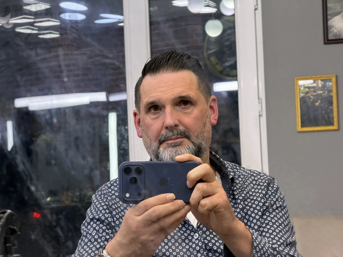
I had planned to get a haircut during my trip, but the choice of barber turned out to be quite random. I took a taxi ride to a كبسة kabsah restaurant, only to find it was takeout only. As I started walking and feeling a bit lost, I passed a barber shop. Without thinking, I walked in and discovered that they didn't speak English or Arabic—they were Turkish.

I did understand that they were advising me to dye my graying beard black, and from that moment on, I simply nodded at every suggestion they made. The whole process took an hour and a half, and at one point, I even looked like a smurf! I paid 100 riyals, which wasn't too bad for the amount of time they spent on me.

Planes, Trains and Automobiles

This was not my most environmentally friendly journey. To get from Al-Hofuf to Jeddah, I had to backtrack by train to Riyadh and then choose between a 14-hour bus ride or a one-and-a-half-hour flight. Naturally, the train station is located in the south of Riyadh, while the airport is in the north, so I had to take a 50-kilometer taxi ride once again. Nonetheless, I reached my hotel in Jeddah before 4 PM the same day.

EMD SD50 diesel locomotive on the Dammam–Riyadh line. The line was opened. in 1981. There is also a second Dammam–Riyadh line via Haradh, which is only used for freight.

Historic Jeddah

I had planned to visit the ancient rock art in the Ha’il region, 90 km northwest of the city of Ha’il. These carvings, dating back up to 10,000 years, are part of a UNESCO World Heritage site. BHowever, Google indicated that the site was temporarily closed. When I contacted tour companies for more information, they confirmed that no tours were currently available. I assumed the extreme heat of the summer season made visits impractical. I redirected my plans to the port city of Jeddah. Historic Jeddah, the Gate to Makkah, is another UNESCO World Heritage site.

When early on in Islam Mecca became an important religious city. Jeddah became the port of Mecca during the reign of the 3rd Caliph Othman ibn Affan. After the opening of the Suez Canal in 1869 Jeddah flourished like never before. The Suez Canal linked Europe and Asia with modern steamboats. The merchants of Jeddah built multi-storey decorated houses, which still exist today. It is clear the old city center is still being renovated. Some older buildings are boarded-up behind fences marked “Ministry of Culture”.

The people of Jeddah love their cats. There are cats feeder stations all over the place.

Modern Jeddah is still very much a merchant city. The amount of shops is impressive. The main import partner of Saudi-Arabia is China, which shows. Roaming the streets were groups of men from Pakistan, Bangladesh and India, all in national attire. The whole scene reminded me of Deep Space 9 space station.

The first night I had some trouble finding a restaurant because in the ancient part of the city there is little food to find. I had to walk for a bit to find an Indian restaurant, which caters for Indian migrant workers. It was incredible cheap for 3 euro including a can of cola and a bottle of water. Around the corner was the Bangladesh Store. These neighbourhoods are populated by mostly male migrant workers from Asia. You don’t see Saudis or women.


الجمعه Friday

My second day in Jeddah was a Friday. This meant that in the morning everything was closed. On Friday families have lunch together and it is only after lunch businesses start opening. This posed a problem for my breakfast. After searching all streets I found a convenience store. But they only had processed food of the worst kind. Because I was very hungry I settled for a couple of cheese puffs. A cat begged for a piece of my cheese puff but I deemed cheese puffs too unhealthy for a cat.

Then I really wanted to drink coffee, but again, no open coffee place to be found. While walking I met a man from Yemen and he took the task upon himself to find a coffee place for me. He asked many guards along the way and we finally found a hidden place in a worn down apartment block. The little shop also sold bread rolls. I tried to pay for his bread roll but he refused. We sat together while I drank my coffee. When we parted ways I was happy I could give him a small bottle of water, which he first refused, but he took the bottle after I pressed him to take it. It was all very polite.

Some parts of ancient Jeddah are beautifully green. And again, cats all around.


Jeddah Central Fish Market

The fish market of Jeddah is one of the best I ever visited. The fish is so fresh some are still alive. It is also a great place to shelter from the heat. When I wanted to eat lunch I looked for a fish restaurant. I was told I had to buy a fish and bring it to the restaurant. A young guy in his twenties went along in my search for a fish.

The restaurant had only two ways of preparing fish: frying or grilling. I needed a fish suitable for one of the two methods. I was told hamor هَامُّوْر, was the best fish for deep frying. Hamor is a type of grouper. Next to the hamor were harid, which is a parrotfish. I decided to buy two hamor instead of one. The weight was one kilo so I paid 40 riyal.

After paying for the fish they needed to be cleaned. There is a special fish cleaning service at the fish market. The price you pay is based on the weight of the fish and I only paid a couple of riyal.

Dhuhr midday prayer time

After my fish were cleaned the guy helping me got a bit agitated. Apparently he realised it was almost prayer time, and the kitchen would be closed very soon. We ran through the fish market with my freshly cleaned fish but were just too late. I had all day so I didn’t mind. At one point he seemed to suggest we were going to pray together but I thought: how can I pray with a fish? I waited in the restaurant and hoped my fish stayed cold enough not to spoil. In the end the prayer lasted just over half an hour.

After prayer the guy came back for me to help me navigate the ordering proces. Frying the fish cost 15 riyal and the sayadia (=fishermans catch) rice cost 12 riyal, a total of 27 riyal or about 6,75 euro. Before I could pay, the guy took out his phone and paid for me. I was a little stunned. I invited him to eat together but he had to get back to work and he disappeared.

Back in the old center I stumbled upon this Sobia سوبيا bar. This sobia is made from barley, cinnamon, cardamon and sugar. It ferments naturally and the taste is sweet-sour.

The rest of the day I just lingered in historic Jeddah. I drank fresh cane juice mixed with lime juice. When the sun set and it became dark I had a bright yellow Arabic coffee and I was happy in my new Saudi sandals. I bargained for 60 percent of the original price and I wondered if it was a good deal or not.

I couldn’t find a Saudi restaurant so I went for a nasi rendang from Sumatra. Jeddah is a great destination. I feel that in ten years time there might be too many tourists but for the moment the place does not feel crowded.

Medina

I had to end my journey in Medina because my return flight was from Prince Mohammad Bin Abdulaziz Airport. This was a rather random choice I made in Amsterdam; I thought the name Medina sounded evocative. I hadn't realized that the city revolves around its religious sites. In fact, the ancient part of Medina no longer exists. The inner circle of the city is dedicated to the newly built Prophet's Mosque and is off-limits to non-Muslims.

Between Mecca, Jeddah and Medina lies the brand new Haramain High Speed Railway, just opened in 2018. I boarded the Spanish Talgo trains at King Abdulaziz International Airport in Jeddah and enjoyed a very comfortable and fast journey to Medina. After checking into my hotel, I took a Bolt taxi to a Yemenite restaurant for lunch, only to find it closed. I decided to walk instead. I bought some dates, but it was impossible to purchase just a few; the shop owner insisted that I buy more. Ultimately, I ended up with a huge bag of dates.

As I was walking, a white car slowed down to match my pace. I assumed it was an unsolicited taxi, but when I waved my hand, I noticed a young girl leaning out of the window, offering me a bottle of cold water. I thanked her and the man behind the wheel. According to the Prophet Muhammad, the reward for praying in the Prophet's Mosque in Medina is greater than that of one thousand prayers in any other mosque. Perhaps this also applies to good deeds done in Medina.

After checking into my hotel, I still held a romantic vision of an ancient city with an old souk to explore. However, upon arriving in the city center, it became clear that nothing old remained. All I could see were high-rise hotels and streams of umrah visitors pouring out of the hotels towards the Prophet's Mosque. I joined the pilgrims but after a few hundred meters, it was forbidden for non-muslims to continue. I felt completely alienated and, for a moment, wished I had stayed in Jeddah. However, while driving towards the center, I had also noticed how close Mount Uhud (جَبَل أُحُد) was. The next day, I could make it my goal to climb Mount Uhud.

The evening ended quite pleasant. I found another excellent Indian restaurant and ended the night drinking chai among Indian, or Pakistani, migrant workers.

My taxi driver Abdullah

Before I could hike Mount Uhud, I had to wait until around 5 PM to avoid the heat. I summoned a Bolt taxi to Al Noor Mall. When my taxi arrived, it wasn’t the usual Toyota Camry but a beaten-up Toyota Hilux pickup truck. “Nice Hilux,” I said, knocking on the dashboard. “Very strong car!” Abdullah replied, handing me a bottle of perfume to freshen up.

When we arrived at the shopping mall, he asked, “Dinner?” He meant “lunch,” and I agreed to eat together. He began driving in search of a restaurant. Abdullah was not a native of Medina; he was a retired policeman, and it took almost an hour before he found a good place to eat. During the ride, he asked if I was a Muslim. When I said I was a Christian, he transformed into a Jehovah’s Witness, insisting that I should follow the true path of Islam and not worship three gods. He was referring to the Trinity: God the Father, God the Son, and God the Holy Spirit. He then apologized, saying, “Please don’t feel bad.”

Once we arrived at the restaurant, we could focus on the food: a huge plate of basmati rice and the best goat meat I had ever tasted. I even got a piece of the liver. Abdullah taught me how to eat with my hand, which wasn’t easy. You shouldn't put your fingers too deep into your mouth. By the time we finished, I had rice all over my legs.

After lunch, Abdullah drove me to my original destination: Al Noor Mall. I tried to make it a paid taxi ride, but he refused. We drove for another 15 minutes to drop me off. He had just one request: I had to seriously consider Islam to save my soul; otherwise, I would end up in hell instead of in the garden.

Al Noor Mall mainly features big brands and was rather dull. I sipped Arabic coffee to pass the time, then discovered a cheaper mall just a 10-minute walk away. If my travel bag had been bigger, I would have bought several dallahs, the traditional Arabic coffee pots.


Mount Uhud جَبَل أُحُد,

Mount Uhud is not just any mountain; it was the site of the second battle between Muhammad and the polytheists of his tribe, the Quraysh. At the foot of the mountain is the Sayed Al-Shuhada Mosque, built in 2017. The small hill in front of the mosque is known as Archers' Hill.

I planned to start my hike at 5 PM, but by 4:30 PM, I was bored waiting, so I set off with a handful of dates and three liters of water in my backpack. Mount Uhud stands at 1,077 meters above sea level, and starting from Medina, you need to climb roughly 300 meters, which isn't too challenging as far as mountains go. However, with midday temperatures reaching 43 degrees Celsius, you have to plan your hike wisely, as the heat can be dangerous.

Just after the city limits you will pass some ancient rock art. These can be found all over Saudi-Arabia.

Even at 5 PM, the heat was relentless, and I had to take a few breaks of a couple of minutes. During my third break, I began to feel nauseous, a sign of heatstroke. I sought refuge behind a rock to find some shade and took a twenty-minute break. After that, I felt better, and when I continued, the sun was low enough that I didn't need any more breaks. The view of Medina was amazing.

My white ghutra was comfortable in the sun. It really protects you from the heat. When I reached a good viewpoint, I stayed to watch the sunset. At a quarter past seven, it was time for the Maghreb prayer. It was fascinating to hear the call to prayer from all the mosques in the valley below. I wondered what would have happened if the polytheists from Mecca had pursued Muhammad further into the mountains. Then again, there is no archaeological evidence of the battle to begin with.

I had noticed an Indonesian restaurant at the start of my hike and was dreaming of bakso all the way down. I opted for the Bakso urat. It was good.


My final day

The area around my hotel.

Breakfast is usually very basic: a chapati, filled with egg, and a mint tea.

Al-Masjid An-Nabawi

For my final day, I returned to the Prophet's Mosque, more properly known as Al-Masjid An-Nabawī (ٱلْمَسْجِد ٱلنَّبَوِي). According to Islamic history, this mosque is the second built by Muhammad and is the holiest site after Masjid al-Haram in Mecca. During the Ottoman period, the mosque was rebuilt several times, and it was only in 1805 that Saud bin Abdulaziz Al Saud took control of Medina. The Wahhabis demolished nearly every tomb, even stripping Muhammad's tomb of its gold and jeweled ornaments. In 1985, during the reign of King Fahd, the mosque was expanded again, leading to the demolition of many surrounding buildings.

Al-Masjid An-Nabawī before the umbrellas were placed.

At one point I suddenly realised there is a Starbucks and H&M located just a few hundred meters from the second holiest site in Islam. Umrah is big business but I was surprised to see Swedish and US global chains so close to a holy site.

The square in front of Al-Masjid An-Nabawi is called Medina Haram Piazza. In 2010 a total of 250 shading umbrellas were placed on the square at an eye watering cost of 4,7 billion riyals. I was allowed to walk as far as the green gate. The umbrellas are impressive.

The eastern part of Medina is one big construction site. All night dump trucks were passing my hotel. Apparently new high rise hotels will be build, connected to the airport by a new shuttle railway. Everything in the name of progress. It is clear that Medina is not on the UNESCO World Heritage list.

Artist’s impression of the future of Medina.

My hotel in Medina.


For lunch I had a vegetable stew which was quite similar to a Moroccan tagine and a porridge made of possibly oat. A small cup of tomato salsa was served along with my meal. This salsa is usually served with biryani or mandi rice. The recipe is easy. Simply put the following raw ingredients in a food processor: 4 medium size tomatoes, 1 medium size onion, 4-5 green chillies, 1 cup fresh coriander leaves, 3-4 garlic cloves, 1 tbsp lemon juice, 1 tsp roasted cumin seeds, 1/4 tsp black pepper, 1/2 tsp salt.

In the afternoon I sheltered in my hotel room. The temperatures were really too hot to walk the streets. The lowest temperatures at night time were 30 degrees Celsius, so the nights were very pleasant.

My flight was for 5 am the next day, which meant I had to be at the airport in Medina at roughly 3 am. I tried to get a rest in my room before I had to take a midnight taxi to the airport. All I could hear were the dump trucks hobbling through the dusty road towards the construction site.

I already own a red checkered and white ghutrah (غُترَة) I bought in Jordan in the 1990s. On this trip I bought three extra. I would love to wear these in summer but the keffiyeh is so politicised at the moment people in Europe will not realise I am wearing Qatari or Saudi headdress.

I wandered into a migrant workers’ neighbourhood and had vegetarian Indian food for dinner: a chana dal I make myself in Amsterdam often and a mixed vegetable dish.

I had a connecting flight from Jeddah to Amsterdam. The Saudi Dreamliner was painted in NEOM livery. The NEOM project is a whole different story and one of world’s more crazier development projects. Criticising the project is one of the reasons MBS had Saudi journalist Jamal Khashoggi killed in Turkey.

Mare incognitum

Sagres » Vila do Bispo 20,2 km, ascent 114 m, descent 179 m

Day two of the Trilho dos Pescadores. After a breakfast of torrada com tomate, coffee with milk and a coffee espresso I headed to the southwesternmost part of Europe.

Before leaving Sagres you walk past a statue of Infante Dom Henrique, o Navegador (4 March 1394 – 13 November 1460), or known in English as Prince Henry the Navigator. Henry was a son of King John I of Portugal. Around that time the Portuguese developed a new type of light ship called the caravel, which enabled them to explore beyond the known territories. Soon the Portuguese navigators mastered the volta do mar, the predictable wind patterns and currents of the Atlantic Ocean. During his lifetime Henry explored Madeira, the Azores and the West African coast. This laid the foundation for later explorations by Portugal, and Vasco da Gama reaching India in 1498.

When the trail leaves Sagres it leads to finis terrae or the end of the known sea called mare incognitum. The landscape changes. Gone are the trees. Presumably because of the battering of the winds of the North Atlantic. The cliffs remain high, up to 75 metres, but the surface of the plain is flat. Only hardy plants survive.

Cabo de São Vicente

This is the southwesternmost part of Europe. The Cape St. Vincent is named after 3rd century Vincent of Saragossa. I think the Rota Vicentina is named after him. He was martyred when he refused to consign Scripture to the fire.

This promontory was considered sacred long before Christianity. The ancient Greeks dedicated here a temple to Heracles and near Vila do Bispo around 300 menhirs have been identified, making it sacred ground in Neolithic times. Today this tip of land sports a powerful light house, its light beam can be seen from 60 kilometers distance, and a snack stand selling the ‘last Bratwurst until America’, which is factual I guess. I ordered an espresso coffee at another stand and walked on.

It seems a German philosopher walked the trail before me. I could almost hear the voice of Werner Herzog in his Bavarian accent: “Would we endure Paradise?” I wondered if I could find the direct quote but Google only offered Gertrude Stein’s: “Wenn du das Paradies ertragen kannst, dann komm nach Mallorca.” But she was American.

For many hours the trail traversed a barren land. Yet, the Sagres Biogenetic Reserve, created by the European Council in 1988, is home to many endemic species.

Portuguese sailing routes (red) during Henry the Navigator's lifetime.

Vila do Bispo

I arrived in Vila do Bispo (population: 5,717) in the afternoon. Because it was too early to check into my booked room, I ordered some cheese, olives and wine in a local tapas place. I didn’t specify the wine and subsequently was served a half liter pitcher. I had it replaced for a glass (‘copo de vinho tinto’). When I returned an hour later for diner, the kitchen was closed.

The only restaurant which was open had lulinhas fritas (fried squids) on the menu, and not much else. That evening my leg muscles were quite close to developing muscle cramp, so I stayed awake until 3 am trying to prevent this earth shattering pain. I managed maybe four hours of sleep before I commenced the third day of my walk the next morning.

Trilho dos Pescadores - Walking North

Vila do Bispo » Carrapateira 15.3 km, ascent 302 m, descent 232 m

This section was one of the more beautiful sections. After an initial uneventful few kilometres the path veers toward the ocean over many rolling hills. There is no shade. When the trails hits the cliffs, the views are spectacular.

I try to bring a book on each journey to fill my time when waiting at the airport, or on a train. I thought the walking travelogue The Places in Between by Rory Stewart was appropriate. Stewart chronologies one of the crazier long distance walks across Afghanistan in 2002, mere months after the War in Afghanistan (2001–2021). He is lucky to be alive. Now I want to hike in Central Asia.
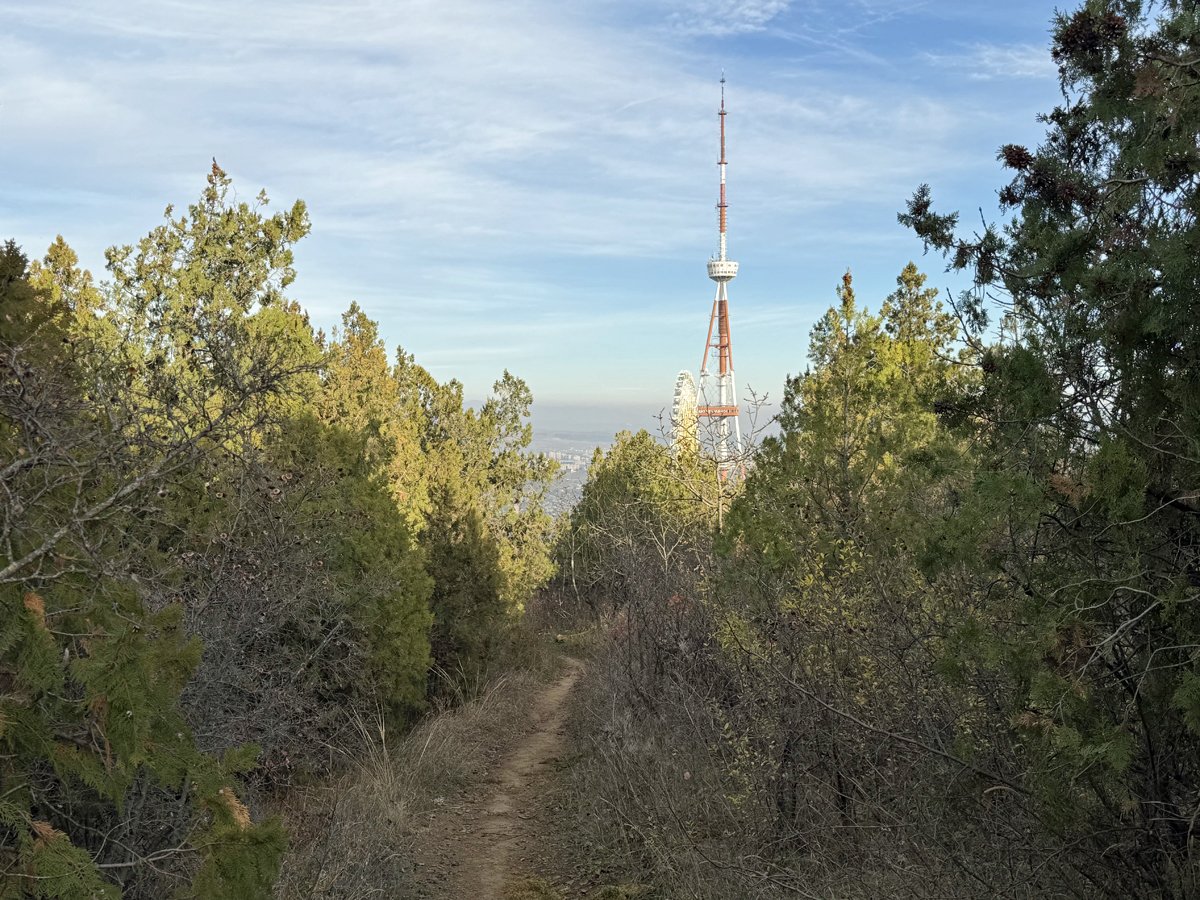
Against the cold and the sun I just brought my Moroccan headscarf. I wanted to travel very light and managed to keep my pack under 4,4 kilos on the weighing scales at the airport. Add 1,5 kilo of water and my pack was about 6 kilos on the trail. I normally don’t take selfies, but it was the only way to check if I was wearing the scarf properly. The knot on my shoulder should have been on the back of my head. I need to practice more.

The village Carrapateira is quite small. It has a local place serving coffee, toast and croissants, but there is no local restaurant open for diner. Just a tourist restaurant in a neighbourhood of holiday homes. Dinner was mediocre and relatively expensive. My toe was pretty painful and I bought a pair of flip-flops so I wouldn’t need to wear my heavy leather Hanwag ‘double stitched’ hiking shoes in the evening and early mornings.


Carrapateira » Arrifana 19.5 km, ascent 236 m, descent 267 m

I wanted to leave early, but the local coffee place was closed until 9. I couldn’t start my day without breakfast, because there would be no possibility to buy anything for almost 20 kilometres. I spent an hour and half cat spotting until breakfast.

After four hours I unexpectedly walked past a small bar like place. It must have been quite new, since it wasn’t mentioned in the description of this section of the trail. Of course I ordered a red wine.

In Arrifana I booked a cheap bed in a dormitory and found a restaurant serving arroz de lingueirãorazor clam rice – with coriander and chilli but no tomato. I had to give it 10 out of 10. It was just so perfect. Good sour notes.

Arrifana is a hotspot for surfers. On the top of the cliff several vans were parked, many with German license plates. I loved the van from Siegburg (SU), which had the following plate: SU RF 2406. A surf dude from Spain was softly playing electric guitar, filling the air with lingering music. Time slowed down.

Trilho dos Pescadores - Reaching Aljezur

Arrifana » Aljezur 17,1 km, ascent 223 m, descent 178 m

Because I had to catch a flight back Saturday afternoon, this was to be the last section of the Fishermen’s Trail. Considering the fact that in Aljezur there is a bus connection back to Lagos, this wasn’t too bad. Not every village has a bus connection.

This section of the trail had quite a lot of kilometres consisting of very soft sand. The landscape was basically a dune landscape. All these days I had been walking within the boundaries of the Southwest Alentejo and Vicentine Coast Natural Park. I had seen stork in their natural habitat flying off the cliffs toward the ocean. Quite a different bird from the storks I am used to in The Netherlands.

Somebody told me that during high season you cannot drive a camper this close to the ocean. Not sure if this is true.

The last day was overall very sunny but in the last hour of my five day hike it started to rain for the first time. Just before Aljezur I passed by this unremarkable stone structure. According to the sign it was water spring of islamic origin and dated back to the 10th century.

Aljezur

Population: 5,884.

Since it was the last day of my walk I treated myself to a fish restaurant. I had hoped to taste goose barnacles, no matter the price, but the patron of Cervejaria Mar (address: R. da Escola 13, 8670-055, Aljezur) told me the ocean wasn’t favourable for harvesting goose barnacles at the moment. You can’t argue with that.

Most dishes on the menu were for two persons or more, so I had to settle for the Arroz de Tamboril (monkfish rice), which was a huge one-pot meal of fresh monkfish, with a chicken like texture, sea shells and prawns. It might not look very big on the photos but I could hardly finish the pot by myself. For a dish like this you must use Carolino, a typical Portuguese rice variety, for the best results. It’s a starchy rice variety, which makes a creamy sauce.

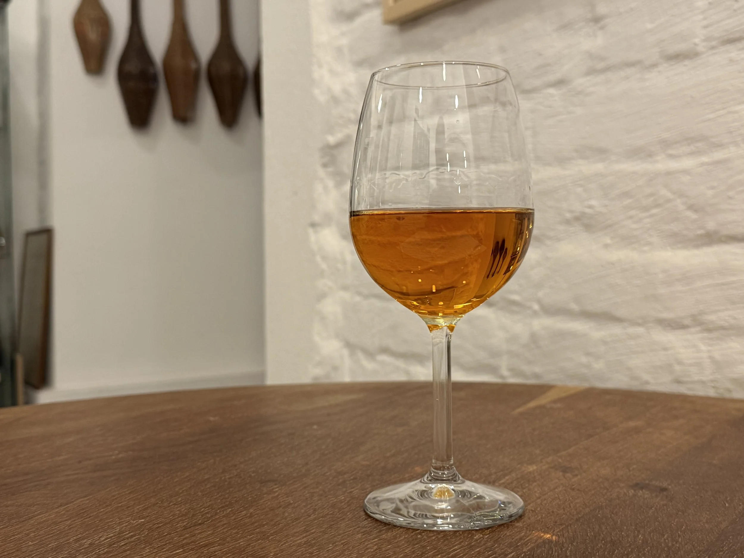
After finishing the monkfish rice I asked for a local digestif. The patron’s eyes lit up and he came back with an earthenware cup of medronho. I don’t drink strong spirits very often but this was both potent (50%) and had a distinctly pleasant taste and smell. Apparently it is made from fruits of the arbutus tree. Until recently it was made like a moonshine by local farmers.


Lisboa Moscavide

On my way back I had half a day to spend in Lisboa between arriving by train at the Entrecampos Station and boarding time. I took a metro to Praça do Comércio, which, apparently, is the most important square of the city. It looks nice enough, but the area is flocked by tourists. I hated it.

Within fifteen minutes I jumped in the metro again in search for something more local. I ended up in the neighbourhood Moscavide, which I traveled through on the first day, because at the beginning of my trip my train to Tunes left at Gare do Oriente.

On the first day I had lunch in a small restaurant near Gare do Oriente: freshly grilled BBQ chicken, rice, fries and salad for just € 7,50 or € 9,00 including a glass of red wine.

Gare do Oriente

I had lunch again in Moscavide in a local bar. I ordered a random soup and was served soup and a bread roll filled with meat. I guess the barman figured that just a soup wasn’t enough. I was so mesmerised by the people around me I forgot to make photos of the scene. There were women, small children, tattooed men with bad teeth, an African man was sitting at my table, stoic like a Buddha, amidst the chaos of crying children and chatting men. Moscavide is my kind of place.

Border town Przemyśl

After 24 February 2022 it became inevitable that I had to travel to Ukraine. I had to wait two years for an opportunity. On 17 February 2024 Ukraine was still at war with Russia but I judged my personal risk for this journey to be very low. Besides, my father survived five years of war in Scheveningen and after 1942 in The Hague. I am not afraid of Russian missiles.

To save time I flew from Amsterdam to Kraków on a KLM Cityhopper Embraer and took the EC Porta Moravica, which runs between Graz and Przemyśl. I bought a first class ticket and was surprised my seat number was in the panorama coach of the Swiss Federal Railways (SBB). The three hour train journey was a luxury I hadn’t experienced in some time, even though the landscape of Małopolska is pretty boring.

I bought Timothy Snyder’s 2010 book Bloodlands: Europe Between Hitler and Stalin specifically for this journey. A first class train is excellent for reading. I arrived in Przemyśl just before sunset.

Przemyśl is built on a hill looking over the river San. Its location is of strategic significance, both economically and military. In 1861, when Przemyśl was part of Austrian Galicia, the first railway line was built between Przemyśl and Lviv. In the years leading up to 1914 the city was turned into the third-largest fortress in Europe. Tensions mounted between the Russian Empire and the Austrian Empire and Austria rightly foresaw the strategic importance of Przemyśl. In the war bloody battles were fought between Austrian and Russia. Both sides lost up to 115,000 killed, wounded, and missing [ source ] in this little city.

After the war, in 1918, Przemyśl was disputed between the West Ukrainian People's Republic (1918–1919) and the Second Polish Republic (1918–1939). The Battle of Przemyśl resulted in a Polish victory in the same year. Przemyśl became part of the Second Polish Republic in 1918 until 1939 when the Second Polish Republic seized to exist.

In 2022 Przemyśl proved its function as border town again when the city helped Ukrainian refugees fleeing the 2022 Russian invasion of Ukraine for which the city received the honorary title of ‘Rescuer City’ presented by the President of Ukraine Volodymyr Zelenskyy. Today there are roughly 60.000 people living in the city, about the same number as in 1910.

The Good Soldier Švejk (Przygody dobrego wojaka Szwejka in Polish) sitting on an ammunition box on the main square. This unfinished work is an anti-war novel, but also anti-establishment and anti-authoritarian. Considering the history of Przemyśl it seemed fitting to me to see Švejk enjoying his beer and his pipe. But not all wars are alike. I am deeply anti-war myself, but the Ukrainians do not need a Švejk in their ranks. They need to win the war. In peacetime we can muse about the absurdity of war. Not now.

The city center of Przemyśl is very clean and has clearly been newly renovated. The city’s history and surrounding landscape is attractive for tourism.

Restauracja Dominikańska

A colleague from work advised me to visit restaurant Dominikańska (address: ul. Pl. DOMINIKAŃSKI 3) and he was spot on. I started with the best potato-herring salad I ever tasted. It was that good. As soup I love Żurek, made from fermented rye flour. Similar soups can be found in other western Slavic cuisines.

Śledź w sałatce z jajkiem, 15,00 zł.

Żurek na tradycyjnym zakwasie żytnim z prawdziwkami, jajkiem i kiełbasą, 20,00 zł.

Pierogi z kaszą gryczaną i borowików, 22,00 zł.

My Booking.com apartment. Artwork like this just emphasises my solitude. They could have gone for a poster of a whale’s tail sticking out of the ocean.

In the years after the end of the Second World War the development of Przemyśl stalled. The city lost its strategic importance. During the years of the Republic of Poland (1947 - 1952) and the Polish People's Republic (1952 - 1989) economic development was not great either. There was no Marshall Plan for Poland. By 1981 the Polish state was insolvent.

When you walk through the entrance of the typical courtyards, the housing blocks look grim. It is only a matter of time these buildings have to be torn down.

The 1861 Przemyśl - Lviv railway line.

Entering Ukraine

I took a 3:10 PM bus to Lviv. I was the only man on the bus. It is just women and children who shuttle back and forth between Ukraine and Poland. The border checks going into Ukraine are pretty straightforward. I had to hand in my passport and got it back after 10 minutes. No luggage check, no questions. This would be very different leaving Ukraine. That border check took three hours.

Polish side of the border.

During my bus ride the sun was slowly setting. Even though the border is open I felt a little victorious when I entered Ukraine. I finally made it!