Road trip Liguria

Autoroute du Soleil - Antibes - Saint-Martin-Vésubie (Alpes-Maritimes) - Monaco - Imperia (Liguaria) - Piemonte - Switzerland - Deutsche Weinstraße

A few days before I was bound to leave for Austria the weather prediction was not good: a fair chance of rain and the temperatures dropped from 30 degrees Celsius to just 20 in Salzburg. I quickly changed gears and took the Autoroute du Soleil to the Côte d'Azur or whatever.

First stop: Alpes-Maritimes

Alpi Orobie, Lombardia

The Bergamo Alps (Italian: Alpi Orobie) are located about 30 kilometers above the city of Bergamo. I made a short stop in Peschiera del Garda on the shores of Lago di Garda but I found the place a bit too busy for my mood. I loved the oleander flowers though. There is a holiday photograph of my mother posing in front of oleanders somewhere in Italy in the 1960s. I have known this photo for many years, but recently I often dream of oleander flowers as a symbol of summer.

Lago di Garda.

Lago di Garda.

I drove on and found a beautiful camping on the shores of Lago d’Iseo. Camping Cave (address: via Cave 13, Iseo, Italy 25049) is located right on the lake. After pitching my tent it was no more than 100 metres to the lake and the (open air) restaurant and bar. Before doing anything else I jumped into the lake.

One of the things I love about Italy is the culture of aperitivo, the drink before dinner, and cicchetti. I prefer Campari Spritz (prosecco, Campari and soda water). It’s bitter and has a beautiful red color. Being camped on the shores of a lake with plenty of cold drinks, meant that each hike would end in a luxury I don’t always experience.

bergamo-5.jpg
IMG_2458.jpeg
bergamo-9.jpg

Valgoglio

27 July 2020

A green wall of trees.

A green wall of trees.

For the first hike I drove to Valgoglio, which was quite a long ride from the camping through dozens of tunnels. The mountain roads were very busy with morning commuters. I didn’t have a map of this area since I only brought maps of Südtirol. I hiked along the river Goglio but when I was deciphering the sparse signs it was clear that the nearest mountain hut above the tree line was too far for a day hike. The Bergamo Alps are something else. The area feels very remote and I encountered few other hikers. Large parts of my hike I didn’t have a cell phone reception.

bergamo-10.jpg

When you spent so many holidays alone, you tend to get some compulsive thoughts while hiking, especially walking uphill. I contemplated a lot on the archetypal Uomo senza nome. ‘The Man With No Name’ was a marketing ploy to promote the spaghetti westerns A Fistful of Dollars (1964), For a Few Dollars More (1965), and The Good, the Bad and the Ugly (1966) with Clint Eastwood. But the original man with no name was Toshiro Mifune’s character in Yojimbo. (the bodyguard) on which Sergio Leone based his 1964 movie. In the opening scenes the rōnin (浪人) arrives at a junction in the road, he shrugs his shoulders, picks up a stick and throws it high into the air. He lets fate decide which path to take; he follows the direction of the fallen stick and walks into a village. And so the story begins. I like the idea of not having a full plan when starting a hike. But even without a plan there is always a plan B.

yojimbo.jpg

Rifugio Magnolini

28 July 2020

The second day I started my hike in Bossico after an other exhilarating car ride with many hairpin turns. From there is was a very hot but easy hike to Ceratello. During the hike there were some good views of the lake. The narrow road during the ascent to Rifugio Magnolini (1610 m.) was very steep. On the way down I took the foot path back to Bossico and my car, through pine forests and long rocky single tracks. This was one of the more beautiful hikes. Below the route I walked.

Day hike: Bossico - Rifugio Magnolini - Bossico.

Day hike: Bossico - Rifugio Magnolini - Bossico.

Lago d’Iseo.

Lago d’Iseo.

bergamo-2.jpg
bergamo-8.jpg

On the way down I walked past a little stone hut marked as ‘ll cadi de la pest’ where the only Bossichesi who escaped the scourge of epidemic in 1630, sought refuge to escape the plague.

The region of Lombardy saw the most cases of COVID-19 by far in Italy. Notably Bergamo province was hard hit by the 2020 pandemic in March. On 8 March a quarantine lockdown was imposed for the whole region of Lombardy and 14 other northern provinces placing 16 million people under quarantine.

By the end of July 2020 quarantine was lifted but many measures were still in place. At the reception of Camping Cave my temperature was measured and face masks were mandatory in the camping toilet facilities. In general a face mask had to be worn in shops and in restaurants and mountain huts when ordering.

ll cadi de la pest.

ll cadi de la pest.

E_guarirai_da_tutte_le_malattie_ed_io,_avrò_cura_di_te,_(Dio_blocca_il_Coronavirus_(COVID-19)_sull'Italia),_china_su_graphia,_Giovanni_Guida_2020.jpg

By Giovanni Guida - Own work.


Europa endlos

Das Leben ist zeitlos
Europa endlos
Wirklichkeit und Postkartenbilder
Europa endlos
Eleganz und Dekadenz.

Kraftwerk, 1977.

bergamo-12.jpg
Last view of Lago d’Iseo before driving to Switzerland.

Last view of Lago d’Iseo before driving to Switzerland.

Corvara, Dolomiti

The car journey from Trafoi to Corvara in the Dolomites took a good part of the day. I stayed at Camping Colfosco, which was less intimate than the camping in Trafoi but still had the right vibe. I arrived in seemingly stable weather, but this was soon to change.

24 July 2020

The first day in Corvara the Alps were covered in a big cloud of heavy rain, reaching all the way from München to Venezia. There was no escaping the rain. I mentally prepared myself to lay in my tent all day. Luckily in the afternoon the rain largely stopped and I walked into the forest to prepare some Dan Cong oolong tea just keep myself busy.

Camping Colfosco in Corvara has some beautiful views of the mountains.

Camping Colfosco in Corvara has some beautiful views of the mountains.

There was no escaping this rain front. The temperatures in Corvara dropped to below 15 degrees Celsius.

There was no escaping this rain front. The temperatures in Corvara dropped to below 15 degrees Celsius.

corvara-12.jpg
Making some spring 2020 Ya Shi Xiang Dan Cong (“Duck Shit Aroma”) in the forest with natural mountain spring water.

Making some spring 2020 Ya Shi Xiang Dan Cong (“Duck Shit Aroma”) in the forest with natural mountain spring water.

Parco naturale Puez Odle

25 July 2020

The second day in Corvara the sun was shining as if the day before never happened. I walked a stunning round trip from Passo Gardena (2,136 m) through Puez-Geisler Nature Park to mountain hut Utia de Puez at 2475 m. and back through Val Longia and Wolkenstein before climbing back to Passo Gardena where I left my car.

Ascent from Passo Gardena.

Ascent from Passo Gardena.

corvara-7.jpg
corvara-8.jpg
Mountain hut Utia de Puez (2.475 m).

Mountain hut Utia de Puez (2.475 m).

Pasta with Hirschragout and some flowers in Utia de Puez.

Pasta with Hirschragout and some flowers in Utia de Puez.

The valley Val Longia below, and the village Wolkenstein in the far distance.

The valley Val Longia below, and the village Wolkenstein in the far distance.

Certainly one of the more beautiful roundtrips I walked.

Certainly one of the more beautiful roundtrips I walked.

Trentino-Alto Adige

‘There is always Italy.’

With all my original travel plans cancelled due to COVID-19 I took the opportunity to go on a hiking trip to the Alps. I drove to the Reschenpass/Passo di Resia between Austria and Italy in the province of Trentino-Alto Adige or Trentino-South Tyrol. Beyond that I didn’t really have a plan. The pass was a bit underwhelming so I drove onwards to a small camping place in Trafoi, just below the mighty Passo Stelvio. Camping Trafoi. Via Tre Fontane, 1, 39029 Trafoi BZ, Italy.

The camping is a cosy hikers’ place. It also attracts bikers who are drawn to Trafoi for the 48 needle curves of the Passo Stelvio on the eastern side. Camping Trafoi also is close enough to the mountains to venture into the mountains directly from the camping.

20 July 2020

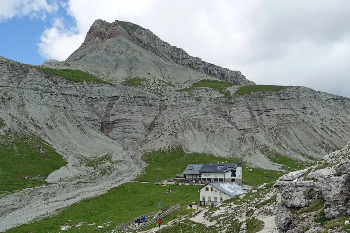
The first day I hiked up to Goldsee, about 1,2 vertical kilometres. From Goldsee you can follow the Goldseeweg with magnificent views leading to Forcola refuge, which is located about 700 metres above Trafoi. The whole round trip takes about 9 hours if you are in no hurry.

In the left of the photo the Stelvio pass from a walker’s perspective,

In the left of the photo the Stelvio pass from a walker’s perspective,

Goldseeweg between Goldsee and Forcola refuge.

Goldseeweg between Goldsee and Forcola refuge.

21 July 2020

The second day in Trafoi the weather was less than ideal. I walked to Berglhütte/Refugio Borletti (2188 m.) for coffee and cake but the afternoon passed by while hiding from the rain in the village.

I learned that Sigmund Freud received a message of the suicide of one of his patients, struggling with sexual problems, while staying in Trafoi, which lead him to his analysis of the Signorelli parapraxis by linking Signorelli to Botticelli and Boltraffio. Freud’s analysis seems like an outdated word game to me. Somehow the bottom line is always Tod und Sexualität.

trafoi-4.jpg
Screenshot 2020-08-30 at 11.00.21.png

Ötztaler Alpen

otzi-map.jpg

22 July 2020

The last day in Trafoi I drove to the small resort village Kurzas, 39020 Maso Corto, Bolzano, Bozen (2.011 m), just past Lago di Vernago, almost 1,5 hours by car from camping Trafoi. I walked from Kurzras to the Schutzhaus Schöne Aussicht - Rifugio Bella Vista (2842 m), a hike of about 800 vertical metres.

In 1991, just on the other side of the mountains, a body was discovered in the melting ice. Amazingly the person had died around 3300 BC. The body was well preserved and contained a treasure trove of information about the living conditions of this dead person who lived more than 5300 years ago. Even his full genome has been sequenced. Kurzas is not the correct starting point if you want to visit the actual Ötzti Fundstelle. The mountain ridge between Bella Vista and the Ötzti Fundstelle cannot be hiked.

Rifugio Bella Vista.

Rifugio Bella Vista.

Fried potatoes and egg at the rifugio.

Fried potatoes and egg at the rifugio.

sudtirol-4.jpg

Above is the mountain ridge behind which Ötzi was discovered. It seems like a very remote place but from the valley it’s only half a day’s scramble. The photo below shows the foot path, which connects modern Italy with the Ötztaler Alpen in Austria over a mountain pass. Only a small stone hut marks the border.

Ötzi lived in the chalcolithic when in Europe the first metal tools were crafted from copper. Later it was discovered that by adding tin you can make bronze, which is harder than both copper and tin. A 99,7% pure copper axe was found near Ötzi. This must have been a very valuable tool. The copper mould was made from ore mined in South Tuscany.

sudtirol-5.jpg
The mummy is now on display at the South Tyrol Museum of Archaeology in Bolzano, Italy.

The mummy is now on display at the South Tyrol Museum of Archaeology in Bolzano, Italy.


Passo dello Stelvio (2.758 m.)

The Passo dello Stelvio is somewhat famous. The pass was originally built by the Austrian Empire (1804 to 1867) in the 1820s to connect the Austrian province of Lombardy (currently Italy) with the rest of Austria. After 1867 the Austrian Empire was succeeded by Austria-Hungary and in World War I the pass saw some heavy fighting due to its strategic importance. Italy entered the war aiming to annex the territories of present-day Trentino and South Tyrol. After the war the pass lost its strategic importance.

23 July 2020

Today the pass on Route SS38 is famous with cyclists and motorcyclists. Since my next destination were the Dolomites I didn't need to cross the pass but decided to drive my car up the pass nonetheless just for the adrenaline kick. How could I not? In 2008 the TV show Top Gear declared the Stelvio Pass in Italy one of the best driving roads in Europe. I am macho enough to not let that opportunity pass.

It was a thrilling experience indeed, especially because the road was quite busy with countless motor bikes, cyclists, other cars, campers and even the occasional line bus. Driving uphill each corner is a blind corner, because only at the last moment you’ll see oncoming traffic. The only two gears you will need are first and second gear. It takes about half an hour to reach the top.

28fb11da141e61c2c3c4d009ebb8ed55.png
passo-stelvio-2.jpg
passo-stelvio-6.jpg
passo-stelvio-4.jpg

The pass itself has several tacky tourist shops. I thought my car deserved a “Passo Stelvio” sticker for the rear window, but only eleven days after my holiday somebody crashed into the rear of my car when I was standing still in a traffic jam on the motorway near Amsterdam. My Renault Clio IV Estate was a total loss. I thought it was a bit ironic, having completed the 48 switchbacks (and many more mountain passes in Italy and Switzerland) without a scratch and then my car being totalled by just being stationary.

IMG_2170.jpeg

My focus on this trip was not on food but this clear broth with Speckknödel in a restaurant on Stelvio pass was just perfect. With all the corona measures still in place I didn’t want to visit restaurants indoors. I mostly cooked in front of my tent and had lunches at mountain huts if I could sit outside.

passo-stelvio-3.jpg

Parc National des Écrins

The Écrins massif is the southernmost massif in the Alps with a summit above four thousand meters. The massif lies in the Écrins National Park, the parts just outside the park perimeter are used for winter sports. After a tip from a running friend, I chose Puy-Saint-Vincent as my first destination. The distance was too long to drive in one day so I camped at the lakeside of Lac d’Annecy on my first night. Sunday I reached Dutch owned Camping Croque Loisirs, which is a lovely, green camping at an elevation of 1450 meters.

Camping Croque Loisirs

Camping Croque Loisirs

Hike 1: Tour du Bal

The first day I hiked an easy route starting from the camping. There was basically one tour which matched my criteria, climbing up to a ridge at about 2700 meters, following the ridge for some time and then down to the camping. It was clearly not a popular route, I just met one other hiker who told me I was walking Tour du Bal. Later I found that the route crossed the Col du Bal, hence the name.

ecrin-6.jpg
The ridge at noon.

The ridge at noon.

ecrin-2.jpg

Hike 2: Glacier Blanc

The second day I hiked to Glacier Blanc, the longest glacier of the park. The snout of the glacier is quite close to a mountain hut. This hut is a starting point for climbs to the Barre des Écrins (4,102 m) and guided hikes on the glacier. The route is quite busy with climbers carrying rope and helmets. This was the only day the weather turned a little foul with low clouds and the occasional rain shower.

Starting point is a parking spot at Pré de Madame Carle at 1874 meters. Le Refuge du Glacier Blanc is located at an elevation of 2550 meters. The 676 meter climbs takes about 2,5 hours and is quite steep at times, steep enough to need metal chains to pull yourself up.

ecrin-24.jpg
ecrin-3.jpg
ecrin-4.jpg

At Pré de Madame Carle I had one of the best salade Niçoise with French mustard dressing. You can make a similar dressing by whisking (optional: garlic and/or shallot) mustard and white wine vinegar together. Whisk in the rapeseed oil, then add the water (whisking continuously) to emulsify the dressing. 1 tbsp Dijon mustard, splash white wine vinegar, 3 tbsp rapeseed oil, 1-2 tbsp warm water.

ecrin-11.jpg

Hike 3: Lac de l'Eychauda

My last day in Écrins I hiked to Lac de l'Eychauda in the blazing sun. About 3 hours to reach the lake and 3 hour back to my car, so a pretty easy hike. The view during the ascent and decent was beautiful.

ecrin-12.jpg
ecrin-13.jpg
ecrin-14.jpg
ecrin-15.jpg

This journey continues here Parco nazionale del Gran Paradiso